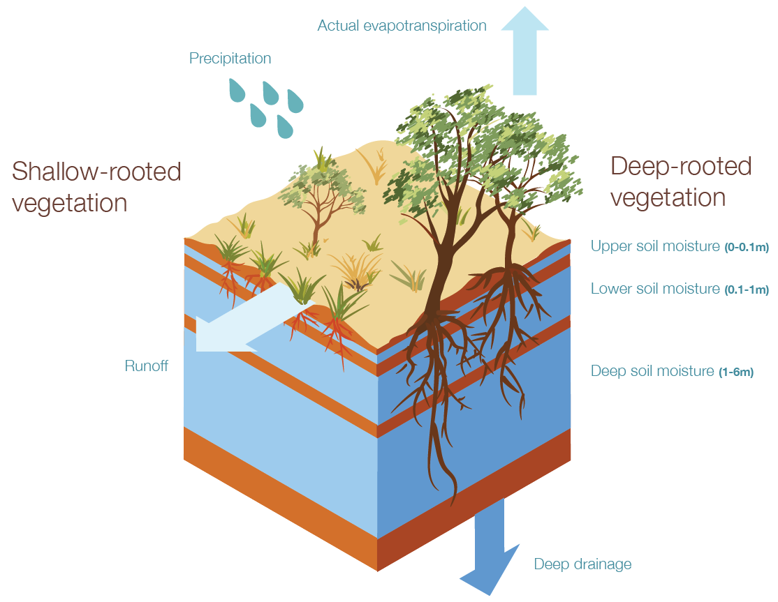
The Bureau of Meteorology (BOM) operates the Australian Water Resources Assessment Landscape model (AWRA-L). AWRA-L is a water balance model operating on a 5 km grid-based spaital scale and daily time scale, simulating the flow of water through the landscape. Water enters the landscape via rainfall, is lost by processes such as runoff, evapotransiration and deep drainage, and is stored as soil moisture. AWRA-L model outputs are used for water resource assessment and planning, agriculture management and flood risk mapping. The AWRA-L model is constantly being improved by BOM and partners (e.g., CSIRO). AWRA-L model outputs can be visualised via the Australian Landscape Water Balance. Only data from the past, with a one day lag, is available using the Australian Landscape Water Balance.
AWRA-L modelling is used in another BOM tool called the Australian Water Outlook. This tool provides a digital twin for the water balance across Australia, whether historically, as short term forecasts (i.e., days to months) or long term projections (i.e., decades). The future looking aspects of this tool are what differ it and the Australian Landscape Water Balance, also driven by AWRA-L model outputs. Estimates are provided for all components of the water balance including precipitation, runoff, evapotransipration, deep drainage into the groundwater and storage of water in soil.
Resources
On this website: