Within the Gilbert River area, the best available DEM dataset is ~30m resolution SRTM data (0.000278°). This DEM is derived from data acquired by the NASA Shuttle Radar Topography Mission (SRTM) in February 2000. Corrections were applied to remove vegetation, and versions of the data are available with smoothing to reduce noise, as well as to enforce known flow paths using mapped stream lines1.
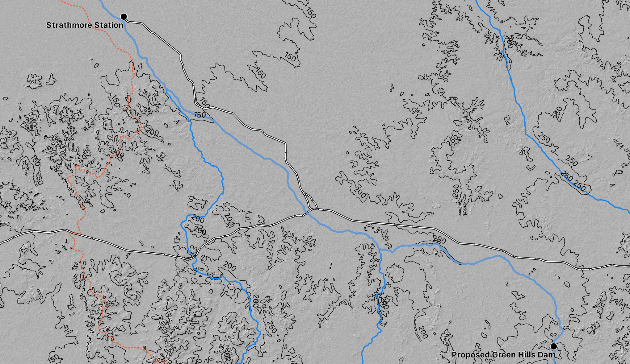
A 30m resolution means that a single height value is recorded for each 30m x 30m grid cell. This is quite coarse for many uses, but can be indicative of catchments and areas that would be flooded at a given water level.
TODO picture of what 30m resolution looks like
Higher resolution data may be available via LIDAR. LIDAR data is available over Georgetown, and mining companies have reportedly run drone-based LIDAR over some areas in the Gilbert River. Airborne LIDAR at 1m resolution was run in some areas by Griffith University in 2006 to look at erosion. This was, however, a test with new equipment, and it is recommended that new LIDAR be flown in the areas of interest with at least 0.5m resolution.
Resources
- SRTM-derived 1 second (~30m) data
- Geoscience Australia summary, Elevation Foundation Spatial Data portal
- Terrestrial LIDAR near Green Hills. Brooks, A. and Spencer, J. (2016). Developing guidelines for agriculture development in northern Australia to avoid and reduce accelerated erosion: the case of the Gilbert/Etheridge River Integrated Agriculture Project. Darwin: Charles Darwin University.
- The Detailed Business Case for the Green Hills dam captured LiDAR in 2019 from upstream of the proposed Gilbert River to 36 km downstream of the Gulf Development Road crossing on the Gilbert River. Approximately 6.5 km either side of the Gilbert River was captured with a vertical accuracy of ±150 mm (RPS 2019)