Watercourse lines depicts rivers, streams and other water related features, often in a GIS setting. Watercourse lines must allow for the flow of water through them, either permanently or sporadically. These features are digitised allowing them to be displayed in GIS software. During the digitisation process it is common for the intricacies of features to be lost. This results in a digital layer not aligning perfectly with the river as seen on the ground. It is also common for digitisation to overlook very small watercourse lines.
There are several datasets available that depict watercourse lines throughout Queensland with different levels of detail and for different purposes.
-
The major watercourse lines dataset includes only significant watercourse throughout Queensland.
-
The watercourse lines - Gulf drainage division is a more detailed dataset that is area specific.
-
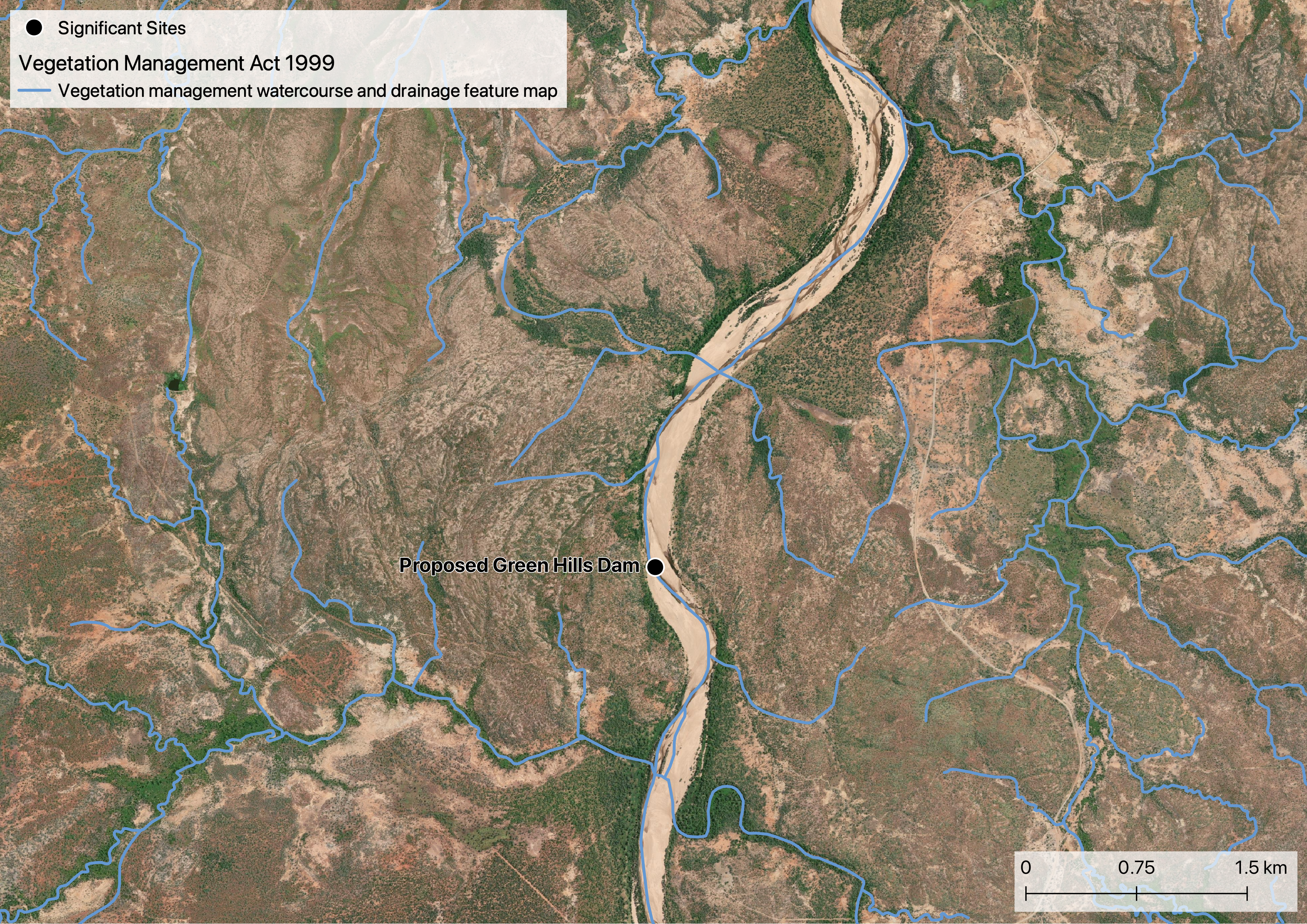
There is also a watercourse and drainage feature map associated with the Vegetation Management Act 1999.
-
Prescribed watercourses in the Gulf Water Plan have also been digitised. There is only one prescribed watercourse in the GRAP - the Gilbert River.
-
There is also a watercourse dataset related to Matters of state environmental significance called Regulated vegetation - intersecting a watercourse.
-
The Queensland waterways for waterway barrier works is related to the Fisheries Act 1994 and the Planning Act 2016. Waterways are coded based on their classification which dictates what kind of development application, if any, is needed.
Based on experience the Vegetation Management Act 1999 watercourse and drainage feature map is superior in terms of matching with satellite imagery and watercourses as observed on the ground.
div class=”rhs_img_container”>
</div>
Resources
On this website:
Datasets
- Major watercourse lines dataset
- Watercourse lines - Gulf drainage division
- Vegetation management watercourse and drainage feature map
- a href=”https://qldspatial.information.qld.gov.au/catalogue/custom/detail.page?fid={6FC98019-1D70-408D-8A02-489FC17CDF35}” target=”_blank”>Prescribed watercourses in the Gulf Water Plan</a>
- Regulated vegetation - intersecting a watercourse
- Queensland waterways for waterway barrier works