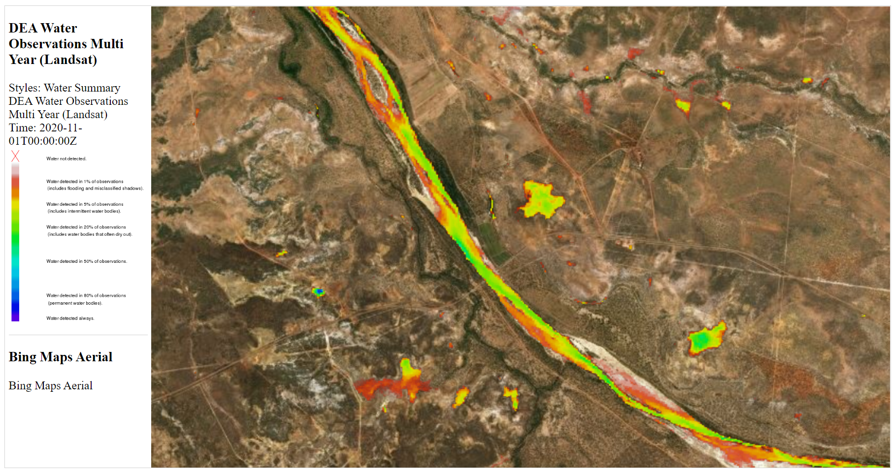
This dataset shows where surface water was observed within each available individual Landsat satellite image since mid 1986. Each 30m pixel is classified as ‘wet’, ‘dry’ or ‘invalid’. Summary statistics show where water is usually, and where it is rarely. This product was previously known as Water Observations From Space (WOfS).
In many places the Gilbert river is wide enough for the dataset to show when it is flowing and dry. It may also be able to show flooding. It may be able to show whether large water bodies, including wetlands and waterholes have permanent water or when they are dry.
Derived datasets are also provided with timeseries showing % area covered by water for mapped waterbodies and wetlands.
Data is not available for every day, and is not available when the area cannot be clearly seen (e.g. due to clouds, shadows, or satellite observation problems), e.g. the January 2009 flood is not visible.
Resources
- Multi-year water observations on Digital Earth Australia - how often was water detected in Landsat observations since 1986
- Digital Earth Australia product description
- Mueller, N., Lewis, A., Roberts, D., Ring, S., Melrose, R., Sixsmith, J., Lymburner, L., McIntyre, A., Tan, P., Curnow, S., & Ip, A. (2016). Water observations from space: Mapping surface water from 25 years of Landsat imagery across Australia. Remote Sensing of Environment, 174, 341–352. https://doi.org/10.1016/j.rse.2015.11.003