Erosion occurs when soil (or another substrate) is removed by water, wind or another natural agent. Erosion is a persistent issue in farmlands across Queensland. Erosion can occur on natural land, grazing land or cropping land. There are many methods to prevent erosion or mitigate where erosion has occured.
Erosion in the Gilbert catchment
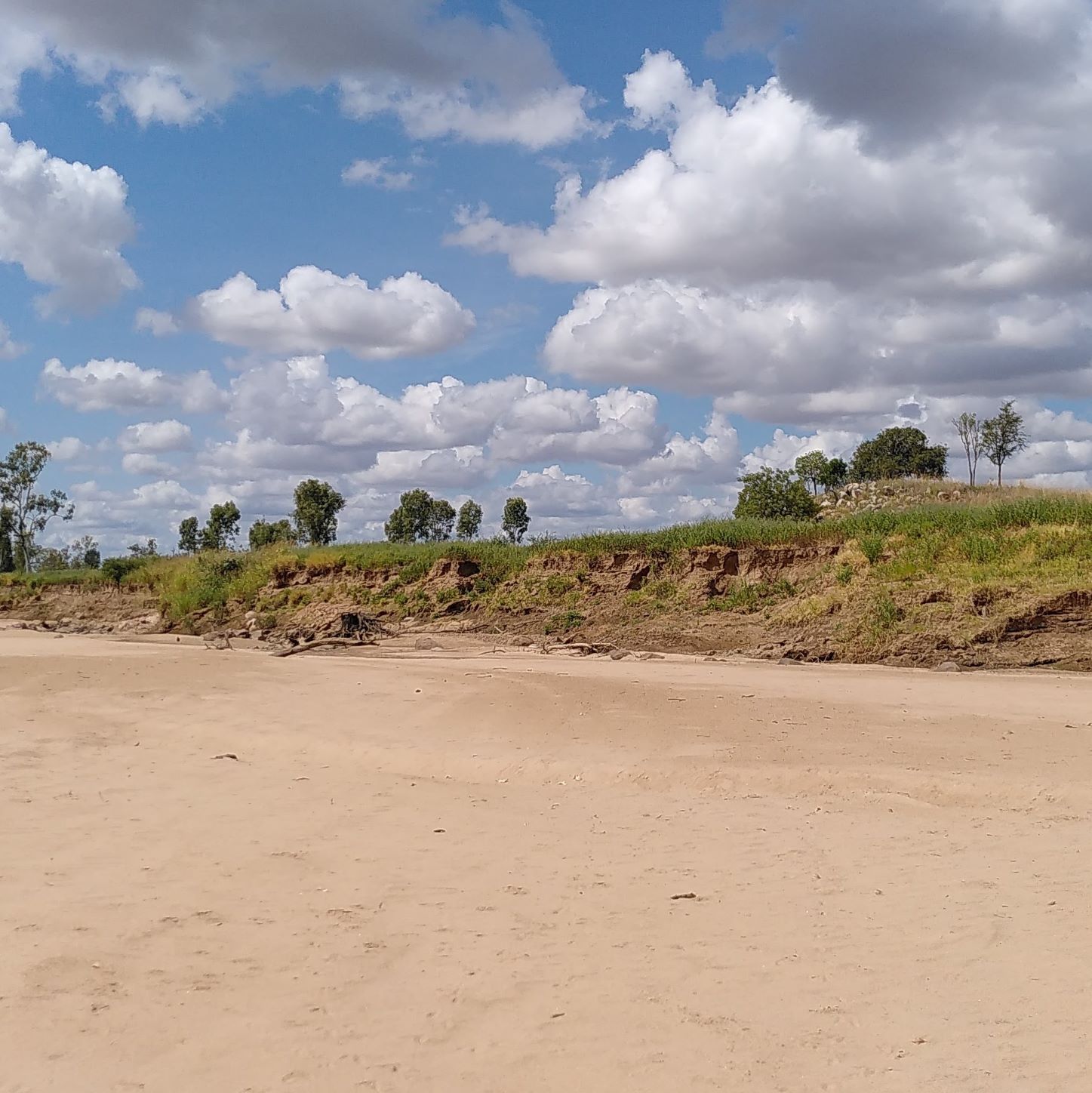
There is evidence of erosion currently occurring in the Gilbert catchment. Some areas suffer from gullying1, including Rockdale and Namuel. Rockdale suffers from sodic soils that tend to be dissolved by water, e.g. when gullies fill with water in the wet season.
</div>
Several past studies have focused on erosion in the northern Australian, catchments that flow into the Gulf of Carpentaria and/or the Gilbert River catchment.
A major finding was that, alike the neighboring Flinders and Mitchell River catchments, sub-surface (e.g., gully and stream banks) erosion is the major contributor to sediment loads in the Gilbert catchment 2. This is a result of the sub-soils in the area being sodic in nature. Sub-surface erosion was not assessed as part of the CSIRO’s FGARA analysis, meaning that the soil suitability classes developed as part of this assessment could be overly optimistic. To reduce the threat of catalysing gully erosion or worsening current erosion, it has been suggested to buffer all drainage lines and existing gullies when moving from grazing to intensified land use (e.g., irrigated agriculture). If required intensive gully rehabilitation could also be undertaken before land use conversion, however, this is associated with a significant cost.
Besides continual erosion experienced in the region (Gilbert and surrounding catchments), erosion events are associated with large monsoonal troughs. After a large monsoonal trough hit the area in 2019, a erosion assessment was undertaken in the area1. This study identified both gully and streambank erosion in GRAP area.
Sand in the Gilbert River has been observed to be increasing. This is likely to be driven by erosion processes, as well as patterns of sand mobilisation and deposition within the river itself.
Land use changes and erosion risk
Land use changes can also change erosion risk. Changing from a grazing system to a cropping system could result in an increase in bare soil that is susceptible to erosion. However, with good management (e.g., minimum or zero tillage as opposed to intensive tillage and subtle retention) erosion risk can be minimised in cropping systems . This is particularly important in monsonal systems like the Gilbert where large rainfall events are common throughout the wet season. Another way to limit erosion is to retain riparian vegetation along watercourses as a way to stabilise banks.
Resources
- Remote sensing mapping programme undertaken by Griffith University in 2006
- Brooks, A. and Spencer, J. (2016). Developing guidelines for agriculture development in northern Australia to avoid and reduce accelerated erosion: the case of the Gilbert/Etheridge River Integrated Agriculture Project. Darwin: Charles Darwin University.
- Mapped Gullies 2008. Figure 8 in Brooks and Spencer 2016
- Alluvium. (2019). Stage 2 Environmental Impacts and Proposed Additional Works Report: Northern Gulf flood recovery assessment and recommended works following the January/February 2019 Monsoon Trough, Report prepared for Northern Gulf Resource Management Group. Includes shape file of field locations/ mapping of areas of streambank and gully erosion.
- Agricultural resource assessment for the Gilbert catchment (Petheram et al., 2013)
Footnotes
- Alluvium. (2019). Stage 2 Environmental Impacts and Proposed Additional Works Report: Northern Gulf flood recovery assessment and recommended works following the January/February 2019 Monsoon Trough, Report prepared for Northern Gulf Resource Management Group
- Brooks, A. and Spencer, J. (2016). Developing guidelines for agriculture development in northern Australia to avoid and reduce accelerated erosion: the case of the Gilbert/Etheridge River Integrated Agriculture Project. Darwin: Charles Darwin University.