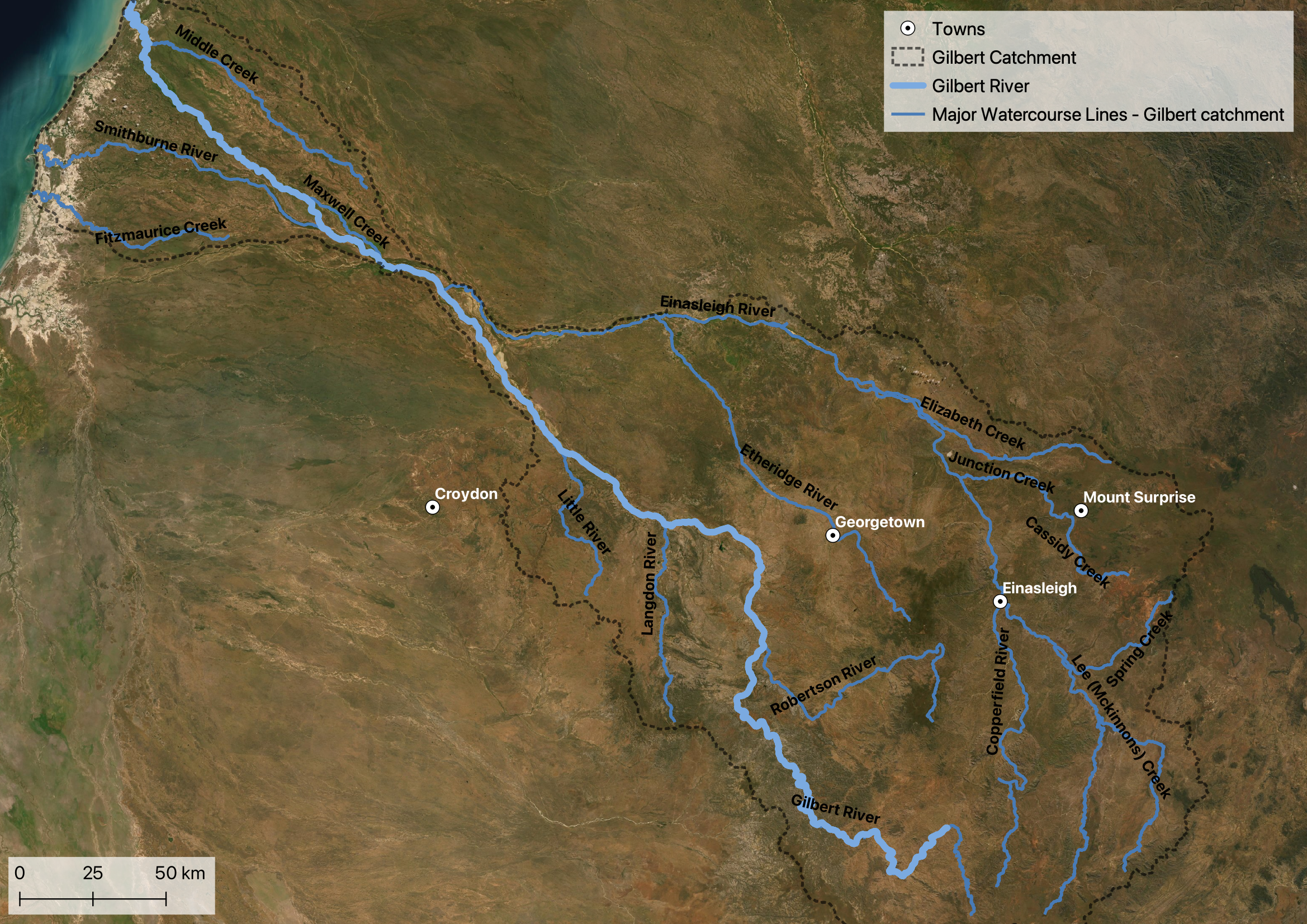
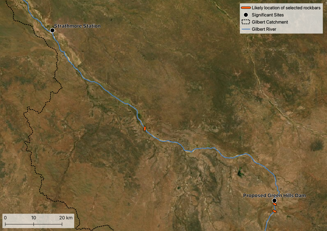
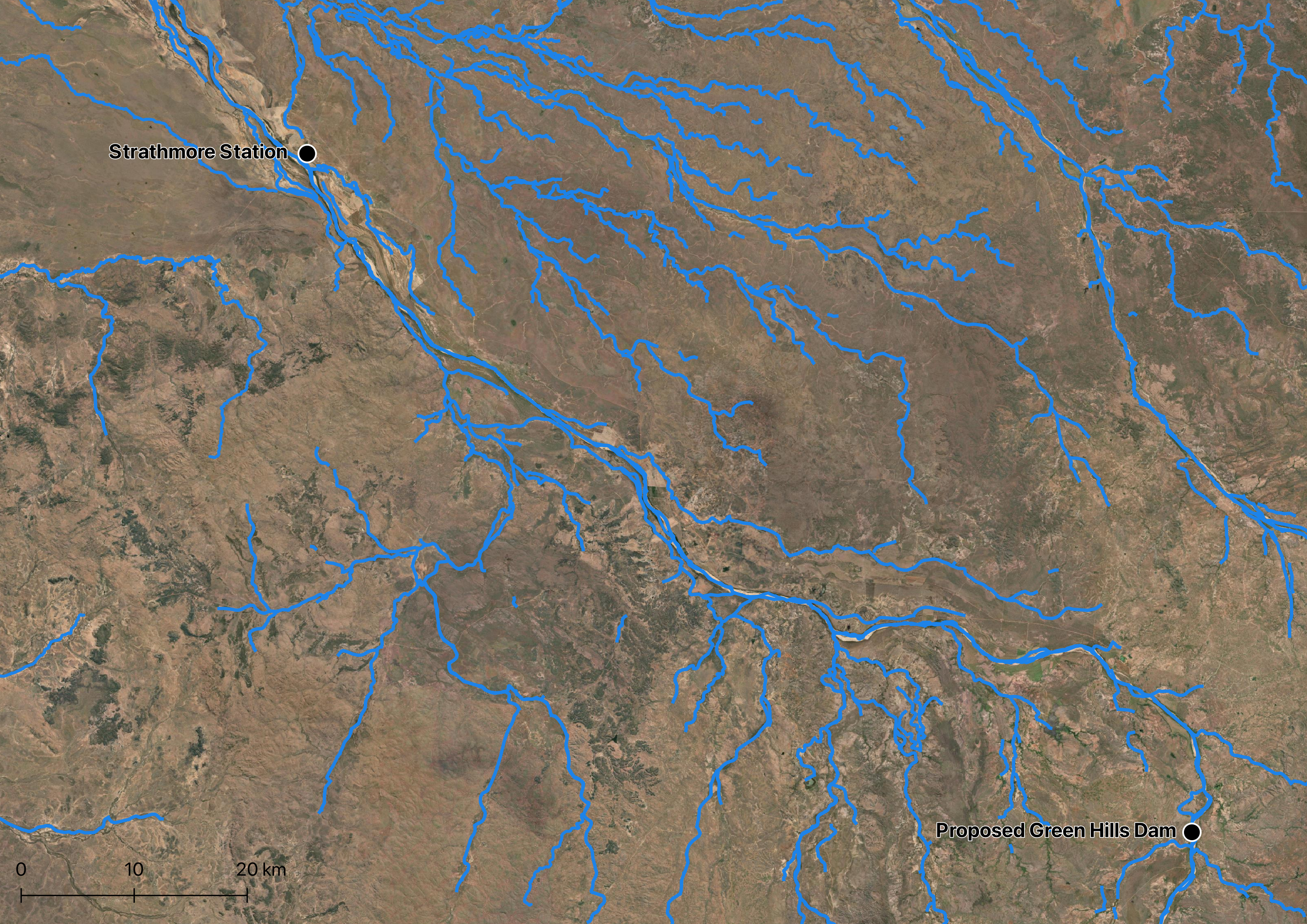
The Gilbert River rises south of Georgetown, flowing north-west to the Gulf. Between Green Hills (and the proposed dam site) and Chadshunt stations (and Strathmore just downstream), the river is joined by the Langdon and Little Rivers and a number of creeks. Along this river reach, broad bed sands are used for agriculture and store water during the dry. The Einasleigh river joins the Gilbert downstream of Strathmore.
</div>
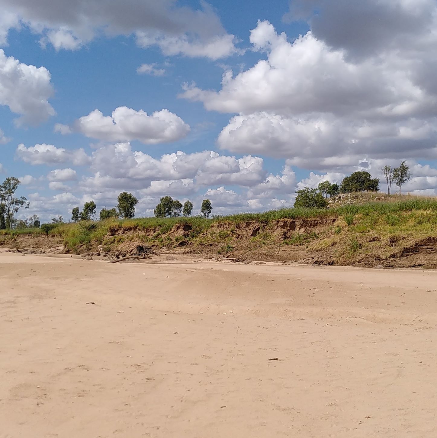
Given the monsoonal climate, streams and rivers including the Gilbert River are typically dry from April to October. Water remains within bed sands of varying thickness, which may form pools of water or may drain over the dry season. Storms early in the monsoon provide patchy rain that may cause flows only in some tributaries. In the Gilbert River Agricultural Precinct the river may flow even if there has not been rain locally if there has been rain upstream. Flows from tributaries may be affected by farm dams.
Taking water from the river is controlled by the Gulf Water Plan. Water is available under the Gulf Unallocated Water Release (2020). Amongst other conditions, water can only be taken if flow at the Rockfields gauge exceeds 2,592 ML/day. Some existing licenses are permitted to pump from the bed sands even during low flows.
There are several environmental objectives associated with the Water Plan (Gulf) 2007 including the maintenance of flows into the Gulf from the Gilbert River. One aim of preserving end of system flows in the Gilbert catchment is to maintain juvenile banana prawn development in the brackish estuarine habitat at the catchment mouth. Maintaining peak flows between January and March, a critical period for prawn migration, would ensure banana prawn populations are sustained. This could be achieved to implementing flow conditions on water take, a condition of the current water release.
Bed sands
Also see: Groundwater
In addition to pumping from the bed sands, water in waterholes and from digging shallow holes in the bed sands is also used for stock watering. Kangaroos have been observed to dig shallow holes in the river for water.
Alluvial sands extend outside the river itself, and are used by stock and domestic bores, as well as deep rooted plants. In sandy soils, plants may form deep roots. It is expected that leucaena, cotton, and sorghum may all be accessing water from the sands in some locations.
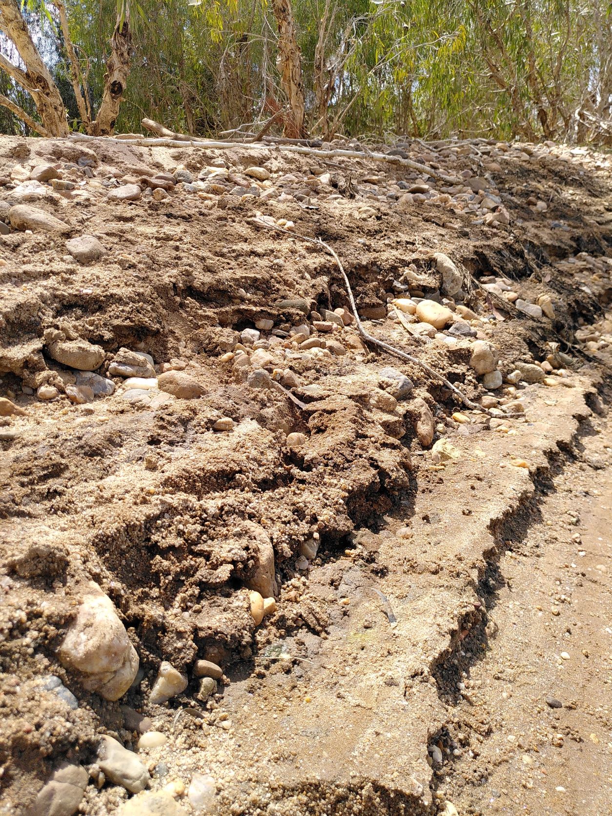
It is understood that flow is influenced by rock bars within the river, which may channel high flows and disconnect or reduce flow between pools of water within the bed sands. The location of rock bars is expected to coincide with rock formations on either side of the river. Further analysis of geology and geophysics could help confirm this.
</div>
Several studies of water in the bed sands are documented in the page on Groundwater.
Flow monitoring
Streamflow is monitored by stream gauges, with the gauge at Rockfields within the Gilbert River Agricultural Precinct.
In addition to the automated gauge at Rockfields, water levels are monitored for flooding at Green Hills and Riverview through the Bureau of Meteorology flood warning system.
Water levels in the Gilbert can rise rapidly, e.g. one estimate is 1m/hour over 3 hours in 2009.
Computer modelling
The eWater Source model is used by the Queensland Government to undertake water modelling in the Gilbert catchment. The model uses nodes to represent where water can enter, exit or be stored, while links connect the nodes and allow for water transfer between them. Groundwater is not explicitly modelled in the Source model, but the interaction between surface and the underlying aquifer is modelled.
The bed sands of the Gilbert River, along the reach where entitlements are extracted, is modelled in the Source model that represents that Gilbert catchment as a node. The bed sands node is represented as a box that includes a valve that releases water from the box. By interpreting the box as uniform (i.e., uniform depth), and with some other knowledge about the aquifer (i.e., specific yield), it is possible to estimate drawdowns within the bed sands. Drawdowns describe the depth to the water table.
There is no current groundwater model of the bed sands. Past work by some of the research team has suggested ways to improve the current model by incorporating processes that dominant in bed sands aquifers (see Section 6 in Feasibility assessment of managed aquifer recharge for cotton irrigation in the Gilbert: Final case study).
The Green Hills Dam Detailed Business Case performed hydraulic modelling to map the area potentially affected by a dam failure (see flooding).
Beyond the catchment scale model, the Bureau of Meteorology (BOM) operates the Australian Water Resources Assessment Landscape model (AWRA-L), which is a gridded Australia wide water balance model. The outputs from the AWRA-L model can be viewed and downloaded from the Australian Water Outlook. Both historical and future projections are available. Model outputs include precipitation, runoff, soil moisture, evaporation and deep drainage.
Flora
The Water Plan (Gulf) 2007 and associated documents (e.g., Targeted review of the Water Resource (Gulf) Plan 2007 - Environmental assessment) highlights the importance of vegetation in the Gilbert catchment. One of the ecological outcomes of the Water Plan (Gulf) 2007 is to support riparian vegetation by maintaining water in the bed sands. Riparian vegetation communities within the Gilbert catchment are predominantly eucalypt and/or tea-tree dominated. Past work has suggested that if the water table of the bed sands were to drop 2.5 metres below the river bed surface would create water stress for riparian shrubs. Under the full utilisation of bed sand entitlements, drawdowns greater then 2.5 metres only occur for a short period (based on simulations), having little effect on adult trees. However, germination and survival of seedlings may be more sensitive to drawdown.
Fauna
Fish need to recolonise each season, perhaps through laid eggs. Freshwater crocodiles can be found in waterholes during the dry. Local observations suggest that fish may have declined over time, possibly related to arrival of cane toads, increase in sediment/decline of water holes, and/or arrival of freshwater crocodiles.
Local observations indicate that fish species could include several varieties of bream, garfish, archer fish, perch, sawfish, catfish and stingray. The Green Hills Dam Detailed Business Case (DBC) found that a fish passage would be required to meet the Queensland Governments Fisheries Act 1994. It was suggested fishways be used to maintain fish passage during and after the dam is built. The DBC also suggested that the early involvement of fish passage experts/consultants and the QLD Department of Agriculture and Fisheries would ensure the best outcomes for aquatic life are achieved, costs are minimized and the dams structure is not compromised. The need for initial and on-going monitoring post dam construction of fish populations and the success of the fish passage was also highlighted in the DBC.
Tributaries
Tributaries within the Gilbert River Agricultural Precinct are not described here, but include:
- Langdon River
- Little River
- Mcdonald Creek
- Log Creek
- Lynch Creek
- Pinnacle Creek
- Pleasant Creek
- Rocky Creek
- Jacks Creek
</div>
</div>
Resources
- Flow at stream gauges, including at Rockfields
- Bureau of Meteorology flood warning system for the Gilbert
- Water Observations From Space (WOFS), showing changing presence of surface water over time
- geophysics, which might give a picture of underground properties of bed sands
- Marsden, T. (2019). Gilbert River Dam, Fish Passage Requirements and Options. Australasian Fish Passage Services Pty Ltd, 49p, as Appendix M in Green Hills Dam Detailed Business Case
- Gilbert River on Wikipedia
Potential studies
- Mapping of rockbars at surface and under bed sands
- Groundwater modelling of the bed sands
- Mapping of upstream erosion, and sediment transport modelling
- Hydrogeomorphological modelling of changing bed sands over time, potentially including impact on and by trees
- Records of fish sightings/catch
Footnotes
- Badu Advisory (2019) Gilbert River Irrigation Project detailed business case – Water strategy report, included as Appendix H in Green Hills Dam Detailed Business Case.