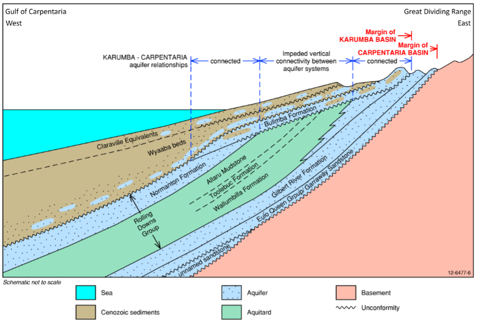
Groundwater includes any water that is held underground. Groundwater can be stored in the soil or within the pores and crevices of rocks. When a substrate contains or can transmit groundwater, the substrate is called an aquifer. As aquifers are comprised of geological formations, it is not uncommon for them to be described as such. There are often layers of aquifers underneath the ground, differentiated by respective characteristics. The layered aquifers may interact with each other but do not have to.
Groundwater system in the Gilbert/GRAP
The groundwater system in the Gilbert catchment and the GRAP is that of alluvial sediments overlaying a deeper groundwater system, with little connection between them.
The alluvial aquifers are most prevalent in current and old riverbeds, often forming localised groundwater systems. The Gilbert River bed sands are such a system. Yields from the bed sands are suitable to support irrigation, with an example being the use of water extracted from the bed sands supporting a mango plantation along the Gilbert River. Anecdotal evidence suggests that some spear bores will run dry towards the end of the dry season while others have abundant water all year round.
There are several underlying aquifers/groups of aquifers including the Bulimba Formation, Rolling Down Group, Gilbert River Formation and Eulo Queen Group. The yields for these aquifers is too low to support irrigated agriculture directly (i.e., would have to be used in conjunction with temporary storage).

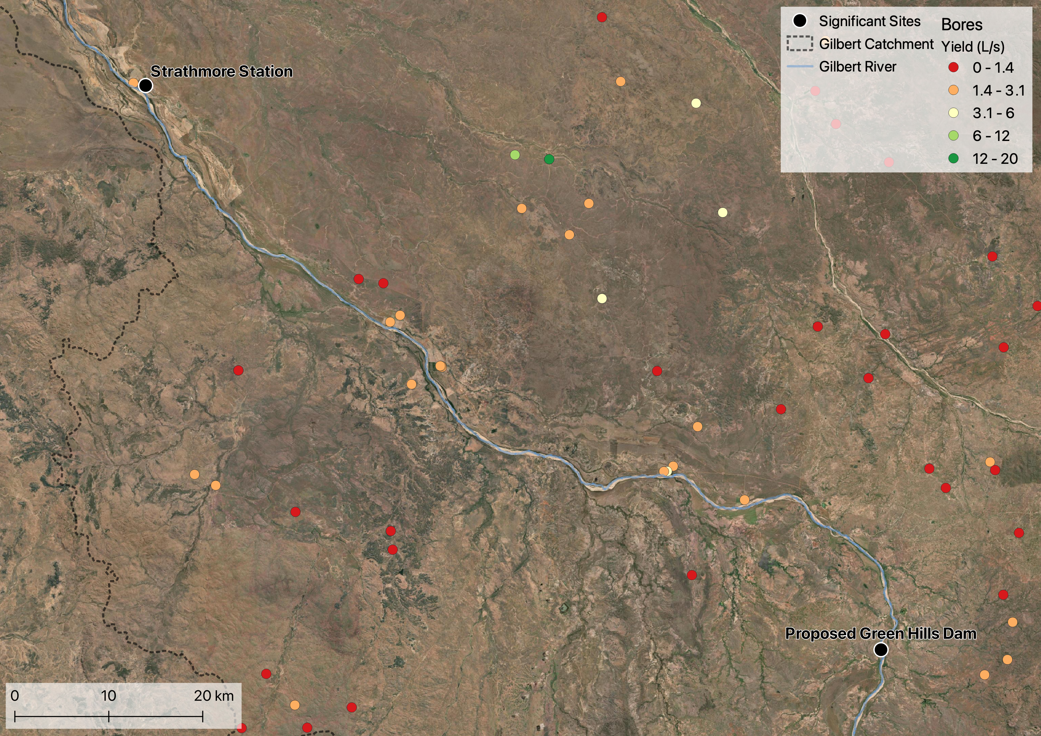
| Aquifer/Formation/Group | No. of bores | No. of bore with yield data | Avg yield (L/s) |
|---|---|---|---|
| Bulimba Formation | 20 | 12 | 2.8 |
| Claraville Beds | 3 | 0 | - |
| Cobbold Metadolerite | 2 | 2 | 0.8 |
| Croydon Volcanic Group | 20 | 13 | 1.5 |
| Elizabeth Creek Granite | 1 | 1 | 1 |
| Etheridge Formation | 8 | 7 | 1.6 |
| Etheridge Group | 9 | 5 | 1 |
| Forsayth Granite | 48 | 30 | 0.8 |
| Gilbert River Alluvium | 5 | 0 | - |
| Gilbert River Formation | 61 | 11 | 2 |
| Inorunie Group | 2 | 2 | 0.4 |
| Robertson River Subgroup | 1 | 1 | 2 |
| Townley Formation | 6 | 6 | 1 |
| Wallumbilla Formation | 1 | 0 | - |
| Wyaaba Beds | 14 | 0 | - |
Groundwater use in the GRAP
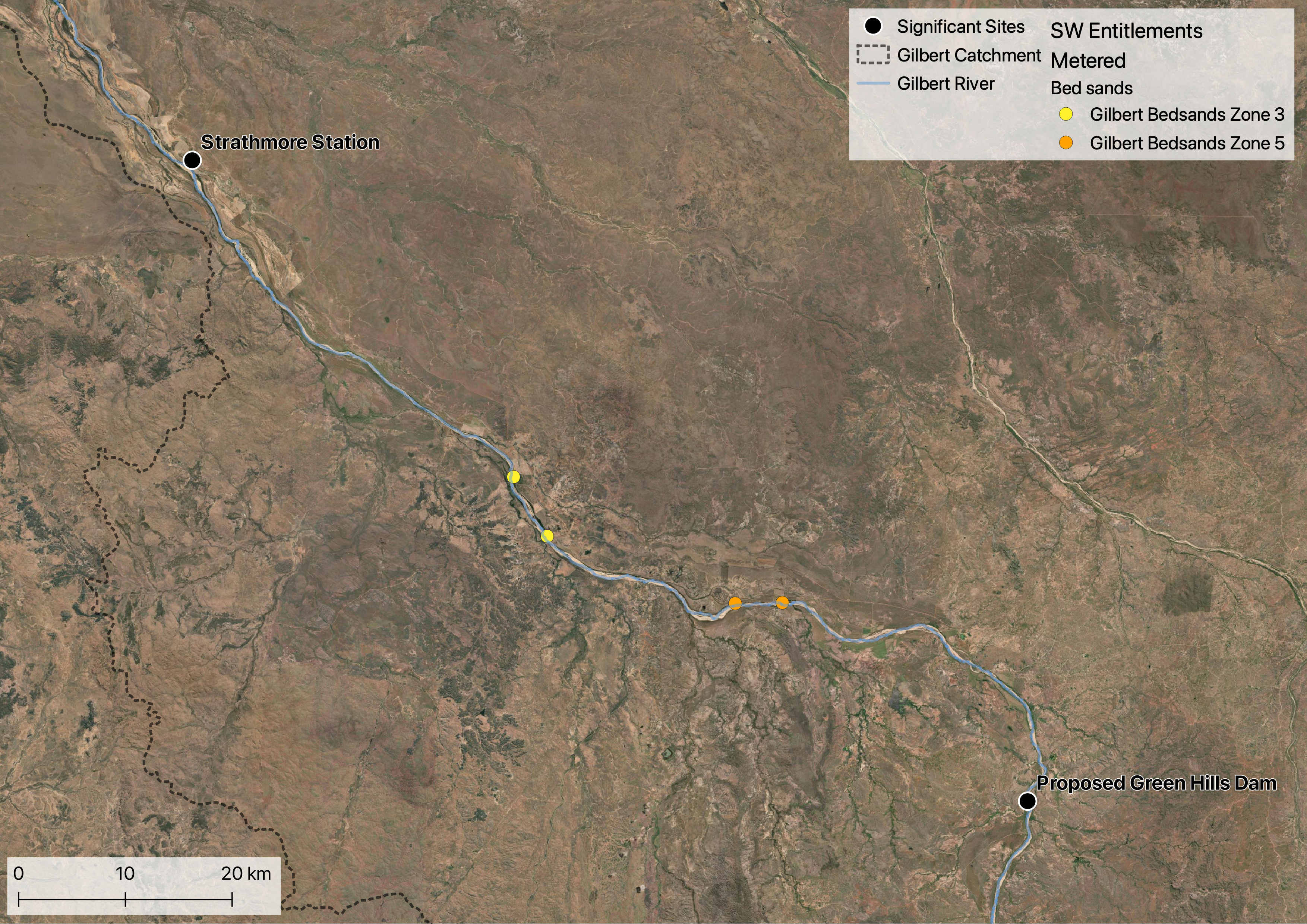
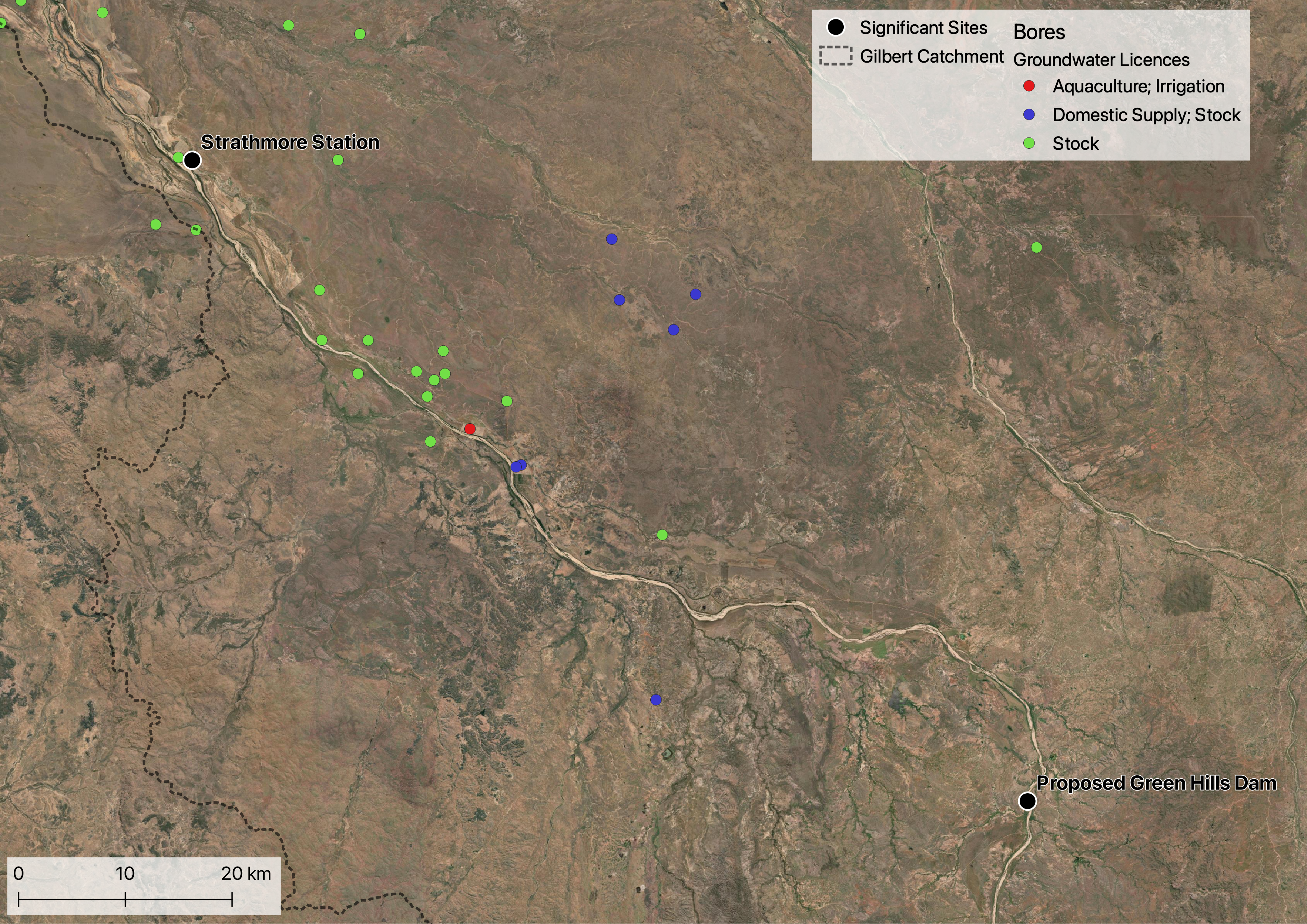
Groundwater use in the GRAP is divided into bores that access below surface aquifers and spear bores that access the bed sands of the Gilbert River.
Several properties hold entitlements to extract water from the Gilbert River bed sands via spear bores throughout the GRAP. There is a total of five such entitlements. Although water is extracted from the alluvial aquifer that underlies the Gilbert River, this water is classed as surface water and managed under the Water Plan (Gulf) 2007 1.
The majority of registered bores in the GRAP (and Gilbert generally) have a registered for stock and/or domestic purposes, and therefore have not associated entitlement. There is only one bore that has an authorised use for irrigation/aquaculture purposes, with an entitlement of 13 ML per water year and is described as accessing the Gilbert River Formation. Management of these bores falls under the Water Plan (Great Artesian Basin and Other Regional Aquifers) 20172.
Resources
- Department of Natural Resources (1998) Gulf Region Study: Gilbert River Bed Sand Investigation Exploratory Drilling Programme
- CSIRO’s Agricultural resource assessment for the Gilbert catchment
- Surface water – groundwater connectivity. A technical report to the Australian Government from the CSIRO Flinders and Gilbert Agricultural Resource Assessment
On this website:
- Water availability
- Water management
- Ecological assets for information on groundwater dependent ecosystems (GDEs)
- Water Infrastructure
Data sources
- Groundwater Database - Queensland. Includes data on the formation the bore accesses, the yield of the bore and construction details among other characteristics.
- Entitlements linked to bores and National Groundwater Information System V4