Several soil types make up the Gilbert catchment resulting from different underlying geology and weathering processes throughout the catchment. The presence of irrigable soils is not a restraining factor on the development of an irrigated agriculture industry in the Gilbert River catchment - there is more soil suitable for irrigation then water to irrigate it.
The alluvial soils adjacent to the major rivers of the Gilbert catchment are most suitable for irrigated agriculture. This partially drove the identification of the GRAP as the most promising region for the development of an irrigated agriculture industry in the catchment. These alluvial soils are deep (1.5 m +), extending up to 2 km from the river. Cropping trials have begun on these soils. Individual crop land suitability maps were developed as part of CSIRO’s Flinders and Gilbert Agricultural Resource Assessment (FGARA), based on soil and climate data. The major crops types previously discussed as applicable to the GRAP (e.g., cotton, sugarcane, soybean, peanut, oats, navybean, mungbean, mango, lucerne, lablab, grape, chickpea, maize/corn, sorghum) were combined to understand overall land suitability of the area.
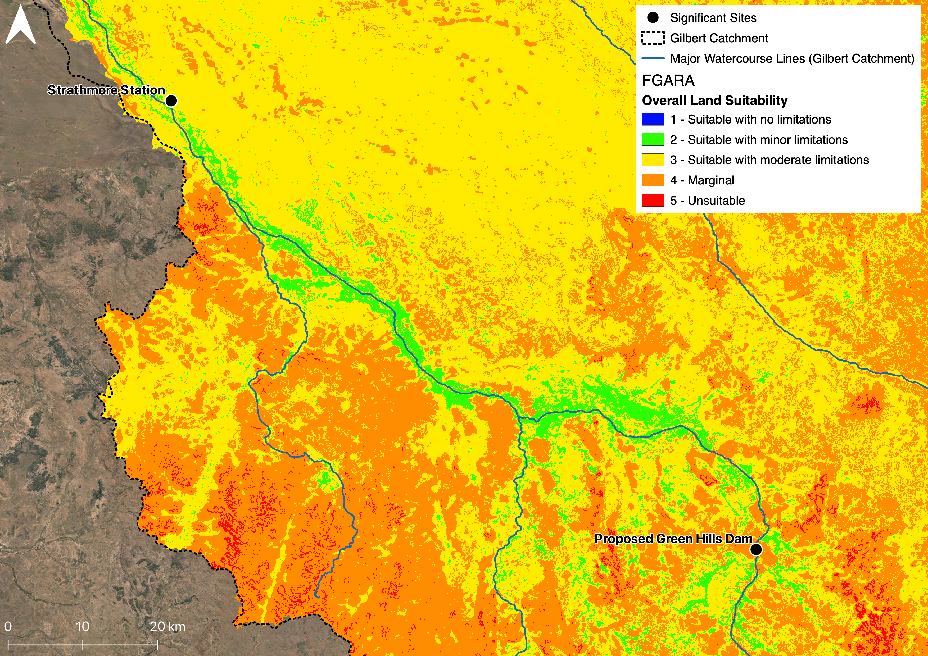
The sandy nature of much of the soil throughout the catchment has been suggested to limit the suitability of on-farm dams, however, anecdotal evidence highlights that specific areas on a farm may be well suited for on-farm water storage based on the natural pooling of water observed by landholders. The differing opinion reached by researchers and landholders is likely an artifact of assessment at different spatial scales. Landholders have expert knowledge of their property while researchers look at a region, missing small deviations from trends.
Resources
- Agricultural resource assessment for the Gilbert catchment (Petheram et al., 2013)
- Soils and Agricultural Land Suitability of the Gilbert River Area; Chadshunt to Mt Sircom, Enderlin N.G. 2000
- An Assessment of Agricultural Potential of Soils in the Gulf Region, North Queensland; A report to Department of Natural Resources Regional Infrastructure Development (RID), North Region; 1:250k, Wilson and Philip, 1999
On this website:
Data sources
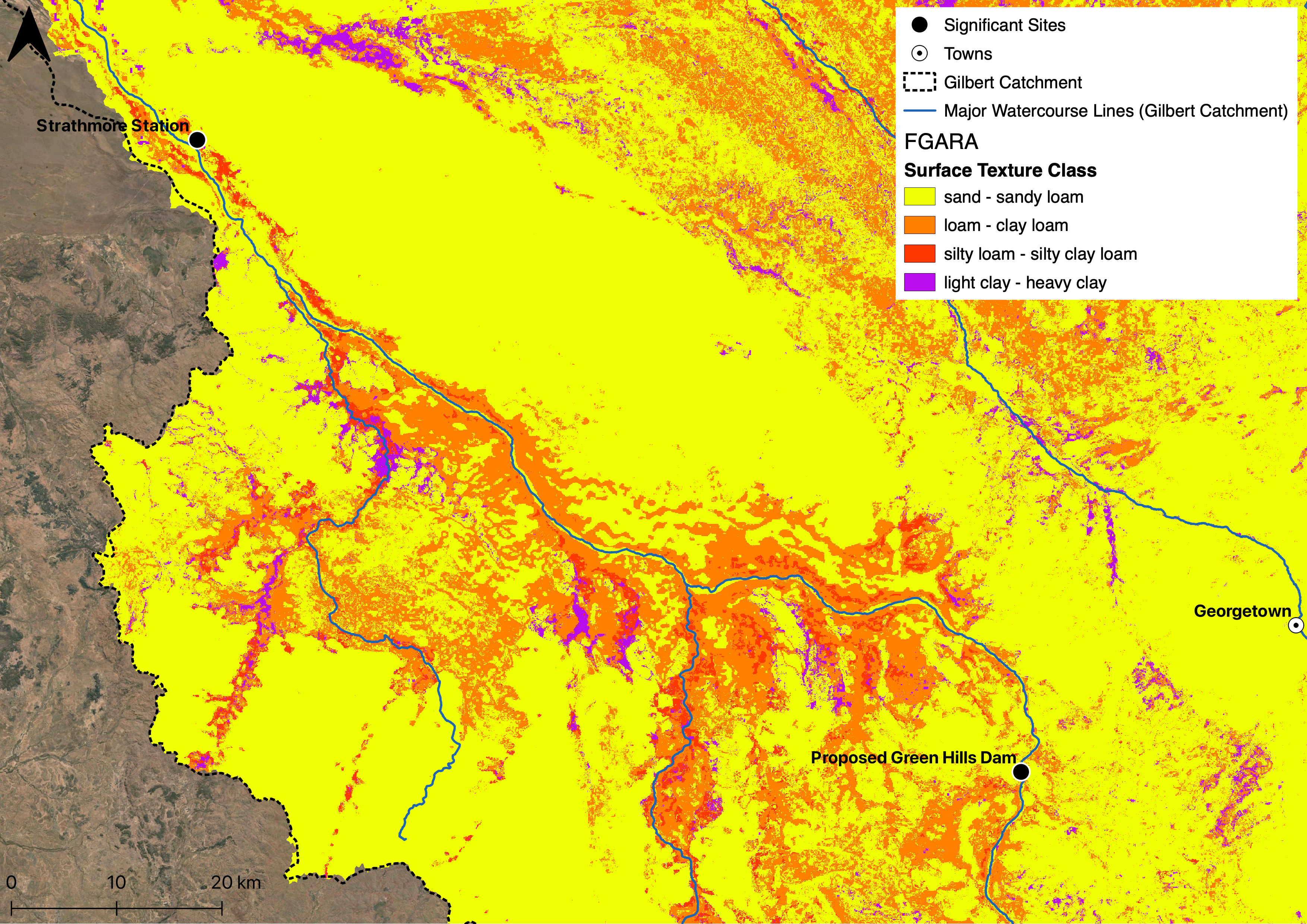
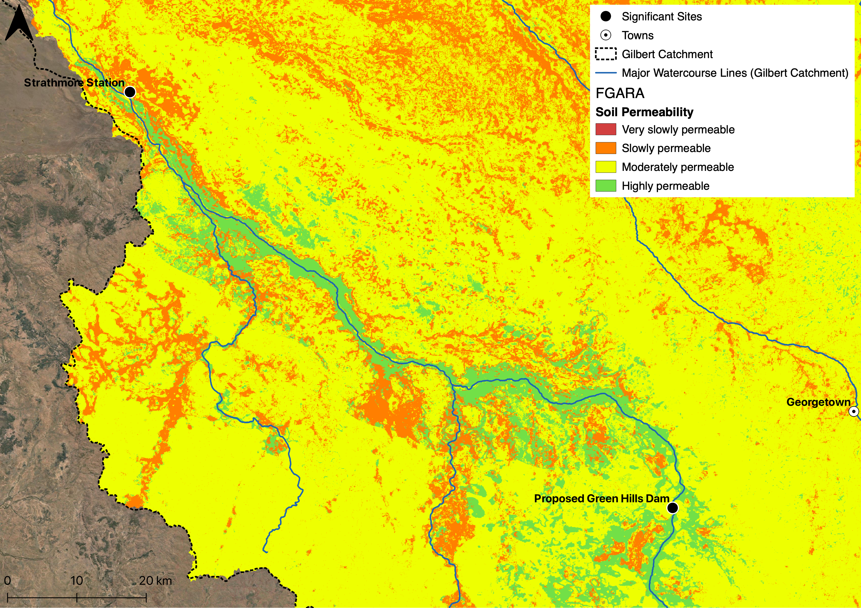
Public data sets from the CSIRO Flinders and Gilbert Agricultural Resource Assessment (FGARA) including soil related data sets:
- Soil Surface Texture Class: sand/loam/clay
- Soil Surface Structure
- Soil Surface pH
- Soil Surface Condition
- Soil Surface Clay Percent
- Soil Permeability
- Soil Generic Group
- Soil Erosivity
- Soil Drainage
- Soil Depth
- Exchangeable Sodium Percentage (ESP) of Soil Surface
- Electrical Conductivity of Soil Surface
- Land suitability for multiple crops
Soil and Landscape Grid of Australia including data sets:
- Clay %
- Sand %
- Depth of Regolith
- Depth of Soil