Surface water is any water above ground. This includes streams, rivers, lakes, wetlands, reservoirs, and creeks. Runoff, where precipitation flows over the land, is also surface water.
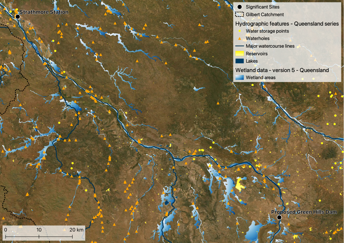
Water bodies, including farm dams, waterholes and wetlands, are important in the GRAP and throughout the Gilbert as they store water from the wet into the dry. This benefits cattle as well as other flora and fauna who seek refugee in water bodies at the height of the dry season.
Watercourses, including rivers, streams and creeks, thread throughout the Gilbert catchment and the GRAP. These watercourse are fed by runoff from the land and in some places groundwater. Alike the water bodies of the region, the watercourse are influenced by the monsoonal climate, with many of the watercourse being ephemeral. An ephemeral watercourse only runs on for a short time. The major watercourse of the GRAP is the Gilbert River, from which water is currently available.
Resources
On this website:
Data sources
Hydrographic features - Queensland series, accessed via Queensland Spatial Catalogue (QSpatial), includes data sets:
- Major watercourse lines
- Watercourse areas
- Lakes
- Reservoirs
- Water storage points Wetland data, accessed via Queensland Spatial Catalogue (QSpatial), includes data sets:
- Wetland areas