Water bodies

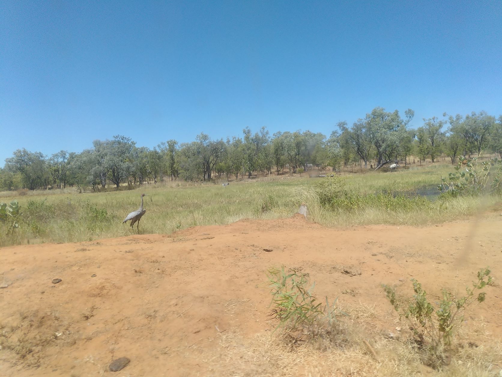
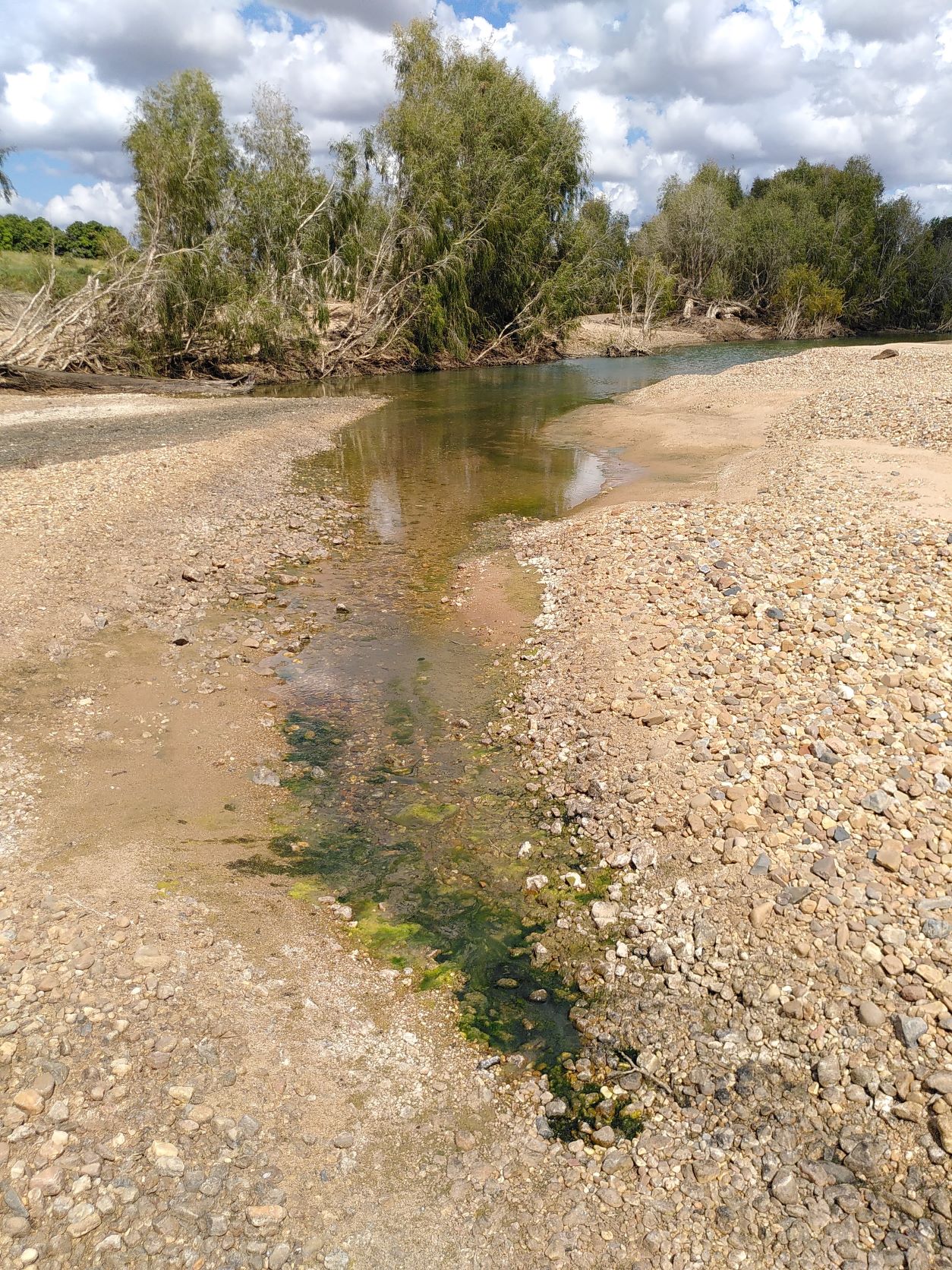
Water bodies in the Gilbert river region are of particular importance because they flood in the wet and water availability is limited in the dry season. Water bodies that are permanent or last longer into the dry season provide water for stock and wildlife, refuges for aquatic life, and storage of water for irrigated agriculture.

Historically, cattle needed to water at the Gilbert River and other streams with waterholes. Farm dams have allowed cattle to graze more widely. Property planning, including mapping, have helped identify gaps, and dams are also complemented with troughs filled by groundwater bores or through pipelines.
View of a small stock dam with a brolga in the foreground and cattle in the background
Small stock watering dam with Brolga in foreground and cattle in the background, April 2022
High evaporation and high infiltration in many areas mean that losses from farm dams are high in the region. They do, however, help support water availability for agriculture. There are nine water bodies above 25ha, with capacities likely exceeding 250ML1, including old mining dams. Capacity of large water bodies is likely to exceed 10GL2. Gully dams especially would be expected to capture runoff (as well as sediment from erosion). Seepage and flows from water bodies may help top up soil water and groundwater.
View of a dam and dam wall with hills in the background
Large farm dam, April 2022
Of the nine water bodies with area greater than 25ha three are known dams (1, 4, 6) with another two (3, 8) being identified as 'Reservoirs' based on the Hydrographic features - Queensland series data set. Water body 3 is split into two, the top section shown as a reservoir while the bottom section is defined a lake. All reservoirs are further characterised as 'rural water storage' meaning that the water held is not treated before use like it would be for town supply. Two of the water bodies (2, 5) are defined as 'Lakes' by the a href="https://qldspatial.information.qld.gov.au/catalogue/custom/detail.page?fid={9D9CBCDA-6D4A-49AC-B993-AEF00B2D16F9}" target="_blank">Hydrographic features - Queensland series</a>. Water body 5 is comprised of both a Lake and a Flat. The final two features (7, 9) are shown as 'Flats' in the Hydrographic features - Queensland series data set. - Water body 1: The largest of the large water bodies, being an on farm dam. The dam wall is on the west side of the water body. Based on analysis2 the volume of this dam is approximately 7 GL. The dam is currently used for stock watering with water being shared with neighbours via releases into watercourses. - Water body 2: Langlo Lake. Defined as perennial by the Hydrographic features - Queensland series data set, which suggests that water is present most of the time. The volume of the lake was estimated at 2.8 GL2. - Water body 3: This water body is separated by a raised road. The top section is reservoir named Goose Lagoon. The bottom section is a non-perennial lake. The volume of both sections is estimated at a little over 1 GL2. - Water body 4: This reservoir is an old mining dam with dam wall on the north-west side of the water body. The calculated volume (~ 1 GL2) is less than the volume as reported by the property owners (~ 2 GL). - Water body 5: The deeper portion of this water body is defined as a non perennial lake while the shallower portion is shown as a swamp. - Water body 6: This reservoir is used to irrigate the adjacent cleared land. - Water body 7: Swamp - Water body 8: On farm dam with dam wall on south-west side of the water body. - Water body 9: Flat land subject to inundation.
Ariel imagery of the nine water bodies in the GRAP with area over 25ha based on the GRAP Surface Moisture Extents - Dry Season 2018
Ariel imagery of the nine water bodies in the GRAP with area over 25ha. Data source: GRAP Surface Moisture Extents - Dry Season 2018 as mapped by Gulf Savannah NRM in 2022 (contact for information)
Some waterholes in the Gilbert river and other streams are permanent or last longer in the dry, as shown, for example, by satellite observations. These waterholes are likely fed by groundwater within the bedsands. CSIRO's FGARA reports reported that rivers in the Gilbert catchment break up into a series of waterholes when the area transitions from the wet to dry season. Such waterholes are essential refugia for aquatic species to survive the dry season. Waterholes fill with sand and others emerge over time. Holes dug in the bedsands often reveal water. Holes are dug for stock watering. Indications are that kangaroos also dig in the bedsands for water. Fish are often found in waterholes as river levels subside.
Small waterhole in Gilbert River with teatrees in background and seepage into waterhole through sand in foreground
Small waterhole fed by seepage through bedsands, April 2022

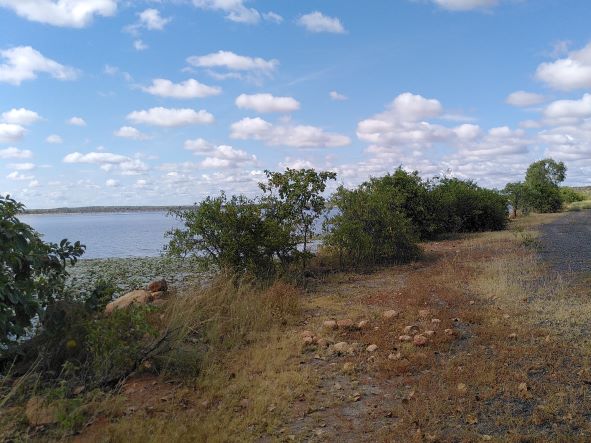
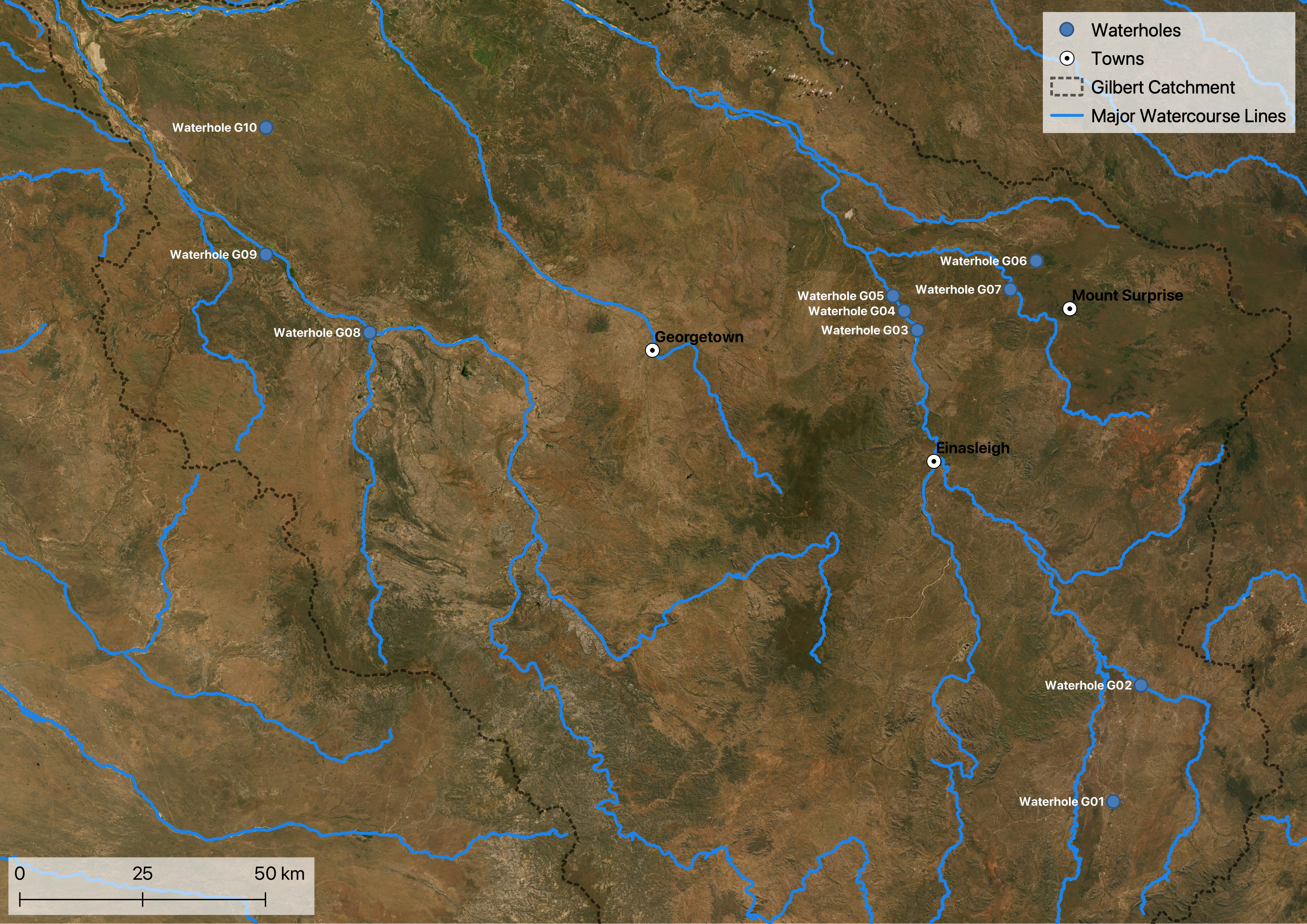
CSIRO’s FGARA project published a technical report on the waterhole ecology of both the Gilbert and Flinders. The study included baseline data collection in the field (e.g., water quality parameters), survey of aquatic biota and modelling of potential development impacts. Ten waterholes were investigated, three of which are in the GRAP region. All studied waterholes in the GRAP were characterised as permanent.

Waterholes in the Gilbert catchment as part of CSIRO's FGARA project mapped
Waterholes investigated in the Gilbert catchment as part of CSIRO's FGARA project
Waterholes in the GRAP as part of CSIRO's FGARA project mapped
Waterholes investigated in the GRAP as part of CSIRO's FGARA project

Seasonal flooding also refills lakes and wetlands. The maintenance of flows into wetlands, floodplains and other water bodies is a stated ecological outcome of the Water Plan (Gulf) 2007 to support habitat for native flora and fauna.

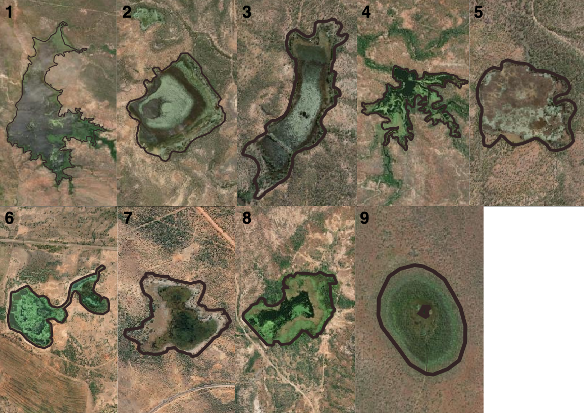
Smaller water bodies are typically implicitly included in catchment scale runoff modelling - they show up through their effect on timing of streamflow after rainfall. Larger water bodies can be explicitly modelled. Water budgets for the catchment of a water body can provide a first estimate of its water balance over time.

Data sources

  • GRAP Surface Moisture Extents - Dry Season 2018, indicative data set mapped by Gulf Savannah NRM in 2022 (contact for information) Hydrographic features - Queensland series, accessed via Queensland Spatial Catalogue (QSpatial), includes data sets:
  • Major watercourse lines
  • Watercourse areas
  • Waterholes
  • Waterpoints
  • Pondage
  • Lakes
  • Water storage points Wetland data, accessed via Queensland Spatial Catalogue (QSpatial), includes data sets:
  • Wetland areas
  • Wetland points
  • Wetlands lines

On this website:

Footnotes

  1. Based on GRAP Surface Moisture Extents - Dry Season 2018, with 25ha providing at least 250ML capacity assuming a minimum 1m depth
  2. Based on GRAP Surface Moisture Extents - Dry Season 2018 (only water bodies exceeding 25ha) and DEM
Last updated: 2022-08-22